Art, Writing and Research
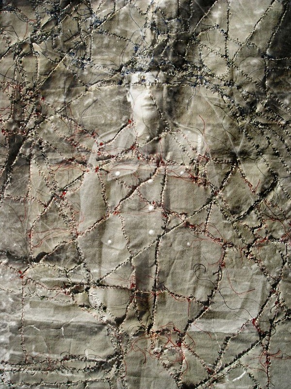
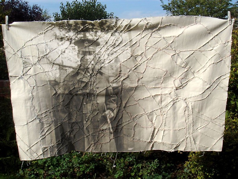
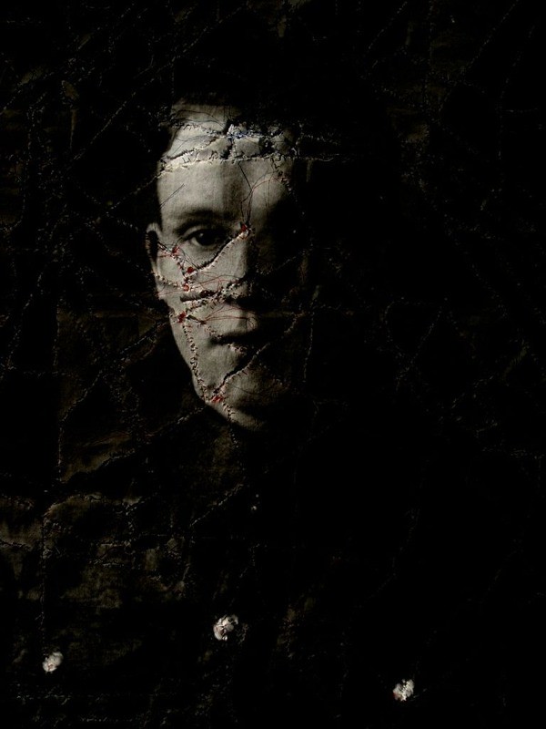
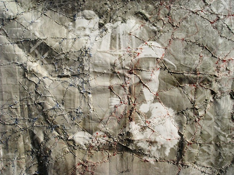
Having completed my last stitching project based on trench maps from World War I, I decided to try and superimpose some postcard portraits onto them, of soldiers headed for the Front. In the first (below) I used the photograph of a family which I ‘projected’ onto the map as shown hanging on a washing line.
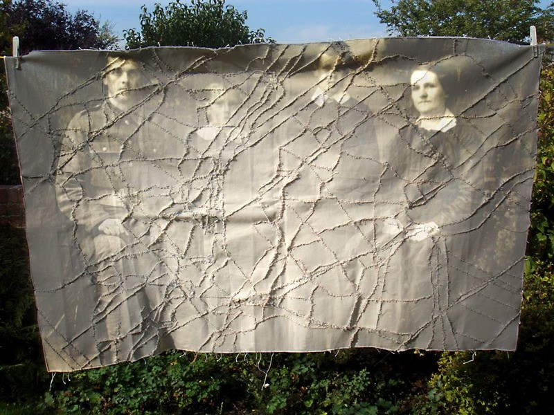
The fact the map hangs on a line like an item of washing, also reinforces the sense of domesticity which is a theme running through some of the postcard portraits, many of which were taken in the backyards of soldiers (or their parents), where evidence of the everydayness of domestic life is in abundance.
One such photograph shows a young couple who’ve recently been married. They stand, unsure of what the future brings, both wearing a look full of apprehension, staring into the lens of the camera, as if this ‘clock for seeing’ as Barthes once referred to them, really could show them the future.
The image onto which their portrait has been projected shows the reverse side of the map, where the threads used to stitch the past together hang like the cut threads of countless lives.
I’ve just completed – after several weeks of stitching – a piece of work called ‘Serre Palimpsest’ the creation of which I’ve been documenting on my blog. It became apparent soon after I started this work that this was a piece with two sides which may seem an obvious thing to say, but it seemed to me that the two sides we’re saying different things, just as things below the surface say something different to those above, whilst as the same time remaining connected.
The two images below show the completed work. The first, the front:
The second, the reverse:
The lines stitched in black show the roads before the war (the modern day road system is pretty much the same), the blue stitching and red show the British and German trenches respectively – with No Man’s Land between, and the green stitching shows the modern day field boundaries.
What was interesting about creating the work was how the threads from the reverse of the piece would emerge into the front, mirroring the way pieces of the past (bits of old shell etc.) find their way to the surface after many years below the ground. The cut lines on the reverse made me think of the paths soldiers would have taken to get there; paths which in many cases were cut in the Somme.
Occasionally, the threads would be tied together on the reverse which again made me think of how our lives today are similar to those who died in that their lives were lived lives too; of course their circumstances couldn’t have been more different, but the fact is that the vast statistics of the Somme comprise real individuals.
To take the photographs I hung the piece on the washing line. The weather was unseasonably hot and sunny, much like the weather would have been on the first day of the Battle of the Somme (1st July 1916). As I looked as the work swaying gently in the breeze, I thought about the photographs taken in the back gardens of those who were about to set off for the Front. I was reminded too of the backdrops used in studio-based photographs.
I’ve just finished the second phase of a piece of work called Serre Palimpsest the results of which can be seen below.
Reverse side
So far I’ve stitched in the roads around Serre and the British and German trenches from the First World War. Next I’ll cut the fabric again to stitch in the modern day field boundaries.
Three patterns will be used for this piece of work: 1) a map of the pre-war road system around Serre, France; 2) a map of the First World War trench system around the same area, and 3) a map of the area’s modern day field boundaries.
A single piece of fabric will be cut, firstly according to the pattern of roads.
This same piece will then be re-cut according to the pattern of trenches.
And finally, this will be cut a third time according to modern day field boundaries.
The final stitched piece of fabric might then look something like this:
Looking at the images reminded me of star constellations, and so I inverted two of the images to see how they looked.
See Serre Palimpsest.
I completed my first three stitched ‘trench maps’ today and have popped them in frames ready to be exhibited in Luxembourg. Ideally they wouldn’t be in frames at all and would be presented on a much large scale, but as first versions go I’m pleased. Certainly I can see how I would like to progress them, adding more layers to create kinds of palimpsests.
Yesterday, I finally finished stitching together the canvas pieces for a workI have tentatively called Repaired Sail of HMS York (1828), refrerring to the prison hulk on which Stephen Hedges was incarcerated before being transported to Australia. The hulk was a demasted ship and on contemporary images (such as that below) one can see how clothes were strung across the ship, almost as if replacement sails themselves.
This piece also alludes to an earlier work of mine called ‘Old Battle Flags‘ which I exhibited as part of my recent Mine the Mountain exhibition. This work – Repaired Sail of HMS York (1828) – was made in response to the old battle flags one finds sometimes hanging in cathedrals. As I wrote in a text accompanying the work:
“Whenever I see them, hanging from their poles, still and lifeless, I think of the wind that would have once shaped them, a wind which would have once blown and turned the pages of history as it was being written. It reminds me that the flags had a place in what was then the present, rather than a scripted, preordained past. I can remember as a child, sitting on the beach when the weather was less than clement, when the wind whipped the sand, drilled the waves and flapped the canvas of the deckchairs. These deckchairs on display still have their colours, and in the main, their shape, but now they are broken; metaphors for times which cannot be revisited.“
The flags hang lifeless without the wind – the past hangs lifeless too. HMS York in this sense is a metaphor for the past – demasted and without a sail, lifeless almost, a prison for the past which in its own present criss-crossed the globe. To re-witness that past we need to see it move again, to catch the wind: we need a new sail.
The sail in this work is made of canvas, and is derived from a pattern made from data recorded on a GPS. The data itself represents a series of nine walks made during the first week or so of the residency here in Newcastle, NSW. As I have discovered through my work over the last few years, walking and being in a particular place and experiencing the everydayness of a place, is vital in our understanding of associated historical events. It is relevant therefore, that this ‘sail’, made to catch the wind and ‘move’ HMS York once again, is constructed from a series of walks.
Below are a number of images of the sail.
Often, it’s the reverse side of a piece like this which proves to be the most interesting, and indeed the most aesthetically satisfying. This particular canvas is no exception. When I turned it over and laid it out, I found the loose threads and knots particularly interesting. Perhaps they remind me the cut lines of past lives or the unwritten lines of text of which, for the most part, history is comprised. Below are images of the reverse side of the canvas.
I’ve made a lot of progress over the last couple of days with video work and with the sticthed map of walks I’m creating, the title of which will be something like ‘The Lost Sail of HMS York’ referring to the prison hulk on which Stephen Hedges was incarcerated in 1828 prior to being transported to New South Wales.
Having cut the templates and pinned them to the canvas, I then drew around each one directly onto the canvas so that I could begin cutting them out and stitching the piece together. To make things easier I will cut each piece as and when I need it so that I don’t get lost as regards where the pieces are meant to go.
The followng stills are taken from further documentary footage I’ve filmed of the process.
A busy day today working on a piece tentatively titled ‘Hammock’ and another which has yet to acquire even a working title. The hammock piece (shown in the photograph imemdiately below) alludes to when sailors died at sea and were sewn up in their hammocks before being cast into the water. The stitching on this particular hammock/body bag is the line recorded on my GPS when I walked the route Stephen Hedges walked from Radley House to Oxford in January 1828.
The hammock no longer has a body inside but what is left is the line. In many respects, the body inside was never meant to be that of Stephen, but rather his life in England, cast overboard along with his clothes when he entered the Prison Hulk York in Portsmouth following his conviction.
I want to dirty-up the canvas a bit and am thinking of taking it down to the sea tomorrow and videoing it lapping at the shore with the waves; something which would lend the work greater resonance.
The images below show the piece being made.
The following images are taken from the second, much bigger piece, which is a canvas comprising all the walks I have made in Newcastle NSW. The walks have been transferred to tracing paper (see Making the Map) and have now been cut up and pinned to the canvas ready for the material to be cut.
The images below are taken from documentary footage of the process.
The map itself isn’t so easy to photograph, but I like the way it looks in its current state, with the cut out templates and the pins. Ideally I would like to inject something of a perfomative aspect into this work, so that the template creation has something to do with the process of tailoring – preparing fabric for an individual.
The video-based performance piece I want to make involves my walking around the exercise yard – in this case for about an hour. The ‘Walk of 4,342 Steps’ refers to a walk I did on 31st October (the first walk in a series of 9 made during the residency) and the final video will comprise my walking with details of the walk read out over the top.
The following stills are taken from the video.
As I walked, and as I felt my body tense up and stiffen (in particular my jaw for some reason) I found myself listening to the sounds from outside, coming through the bars in the ceiling. Again this seemed to illustrate my work, as regards the idea of the constrained walk being analogous to history’s relationship with the past, where the wider past can only be ‘glimpsed’ to some degree through the bars.
Having completed all the walks the next task is to tranfer them all to tracing paper so that templates can be cut and the map re-made on – or rather with – canvas. Taking the GPS plan, I divided it up into 8 segments, each of which I printed out onto A4 pieces of paper.
I then began scaling each piece up onto A1 heavyweight tracing paper, first marking all the dots and then joining them together. I would like to develop this whole aspect of the work, using the metaphor of sea-faring and map-making generally. Given time constraints however, the process will have to remain absent of any ‘performative’ aspect.
Having plotted the position of the dots, I then set about drawng in the lines.
Once copied, I joined the sheets together to make the fullsize version of the map which is now ready to be cut into templates.
During the first week of this residency, I carried out a number of walks, the routes of which I recorded using GPS.Collecting all these walks together, I created a map of all the walks which can be seen in two images below. The first shows the pattern as revealed in the GPS software, the second in Google Earth.
The next phase for this work is to divide the the first image into segments, each of which can then be tranferred to heavyweight tracing paper, after which the lines will be cut and the pieces left behind (i.e. the spaces in between the walks) transferred to canvas.